
KEYSTONE
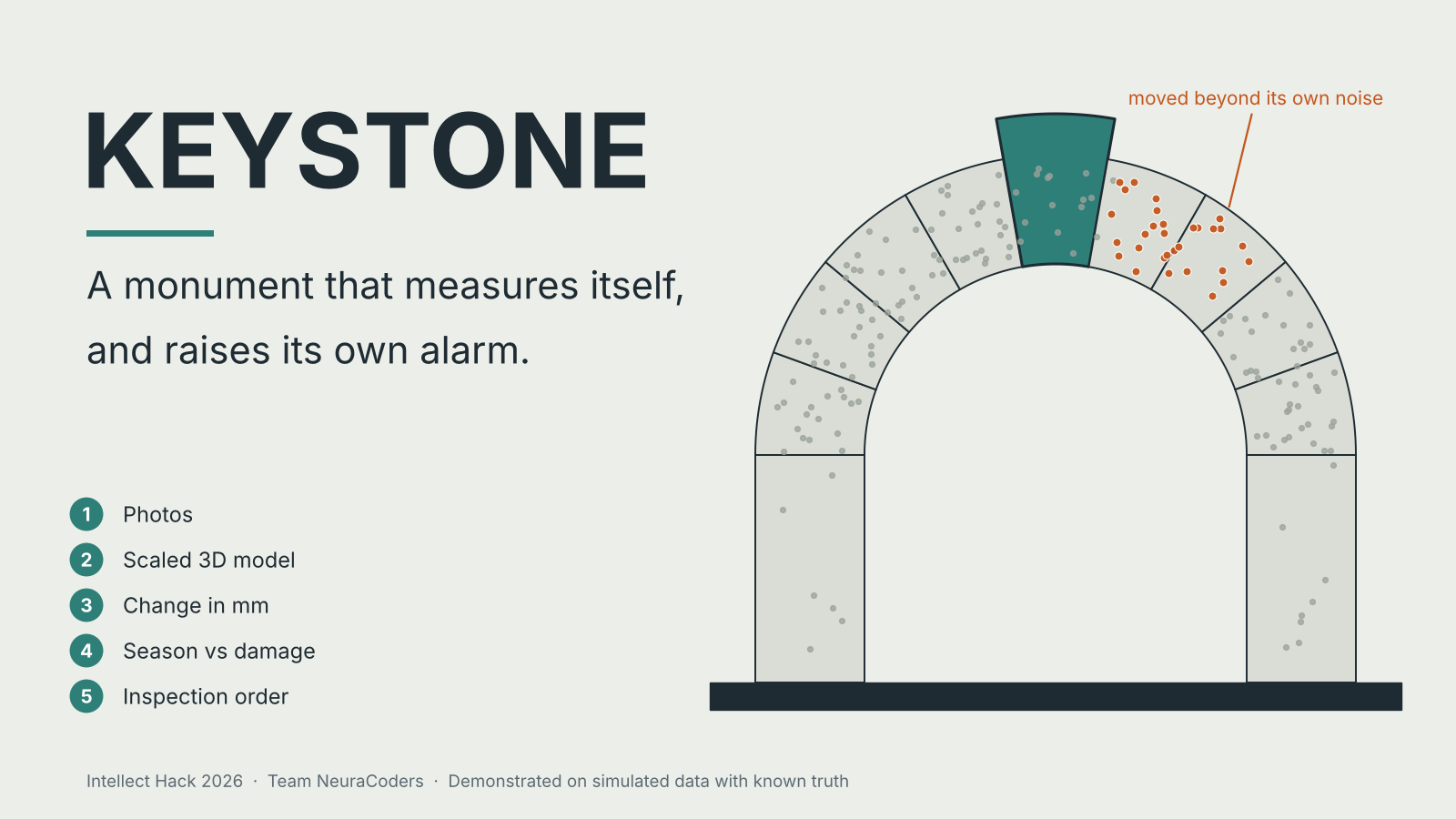
Helping monuments detect damage before it gets worse.
Demo video
What it does
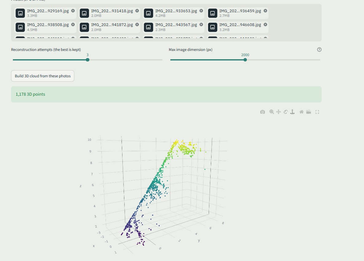
India's protected monuments are still checked by hand, so damage can go unnoticed between inspections and be found late. KEYSTONE helps heritage teams monitor monuments and spot structural changes before they become serious problems. We use photos taken with a phone or an affordable drone to create a scaled 3D model of a monument. We then compare it with earlier scans to measure how much different parts of the structure have moved. We also account for measurement uncertainty, so small differences caused by noise aren't automatically treated as damage. Laser scanners offer millimetre-level accuracy, but an entry-level scanner such as the Leica BLK360 G2 costs about $28,700, and a survey-grade FARO Focus Premium costs about $66,000 to $84,000. Scanner software licences add about $1,000 to $4,000 or more per year. KEYSTONE starts with phone photos and printed scale markers, which makes repeat captures affordable and lets teams catch changes earlier through more frequent monitoring. Our photo-based accuracy target is 1 to 3 cm, and it has not yet been tested on a real monument. The hard part of monitoring is telling real damage from normal seasonal movement. Stone expands and contracts with temperature and weather, so a simple threshold can trigger unnecessary alerts or miss gradual movement. KEYSTONE learns the monument's normal behaviour and flags changes that go beyond it and persist over time. Our dedicated crack model adds another source of evidence. The system assigns each alert a severity level and generates a printable inspection order for the relevant person. We store records in an archive and check them for tampering. KEYSTONE supports inspection decisions, while the final decision stays with the heritage custodian.
Inspiration
We wanted to explore how technology could make heritage conservation more proactive. A monument can develop structural problems gradually, and we wanted to build a system that helps conservation teams measure these changes, keep track of them over time, and see where attention is needed. A CAG audit found no complete physical survey of India's 3,698 protected monuments since Independence. Of the 1,655 monuments it inspected, 92 could not be traced. This made us interested in finding an affordable way to support more regular monitoring and help conservation teams identify problems earlier.
How we built it
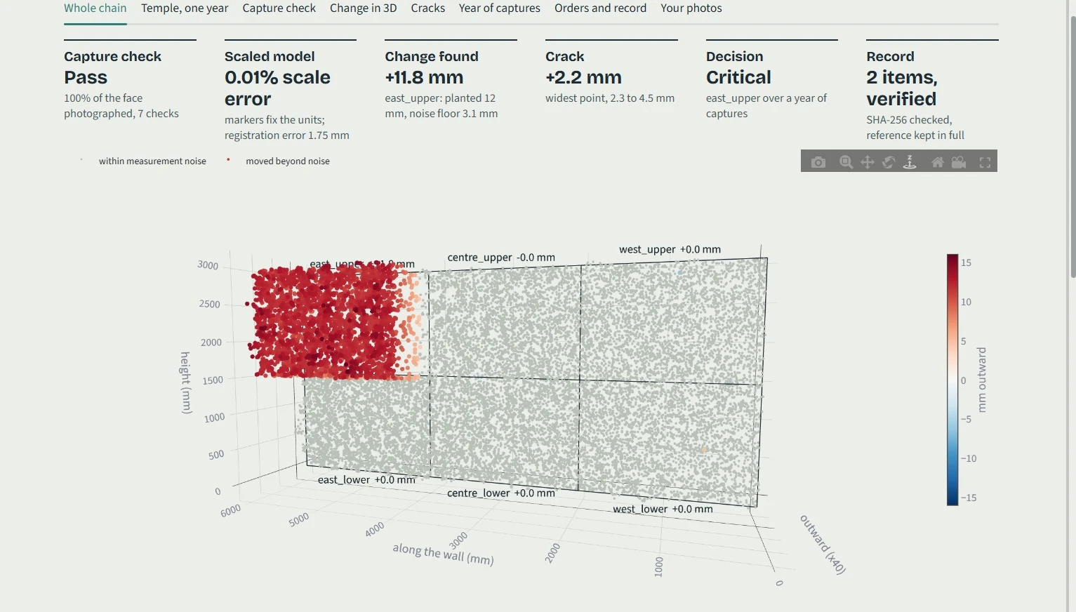
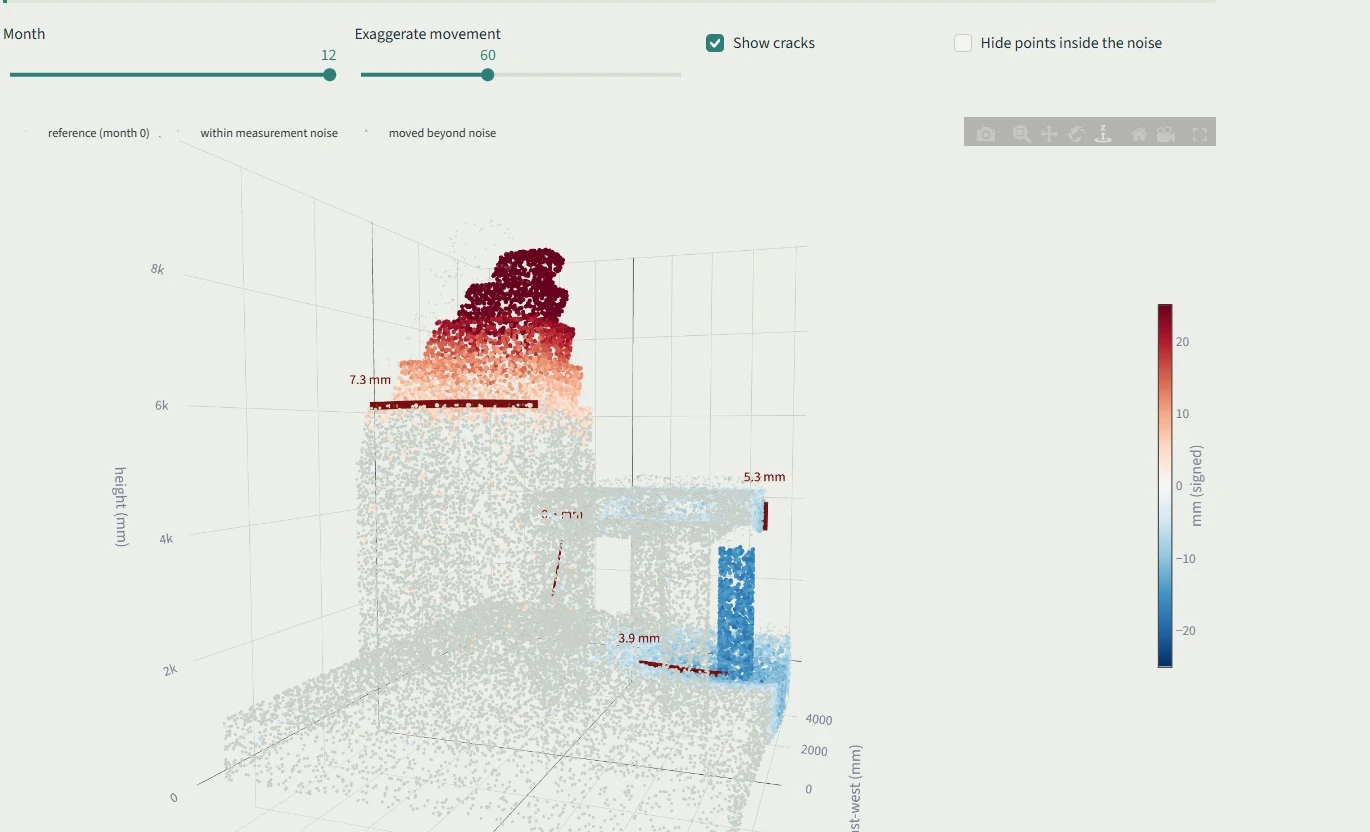
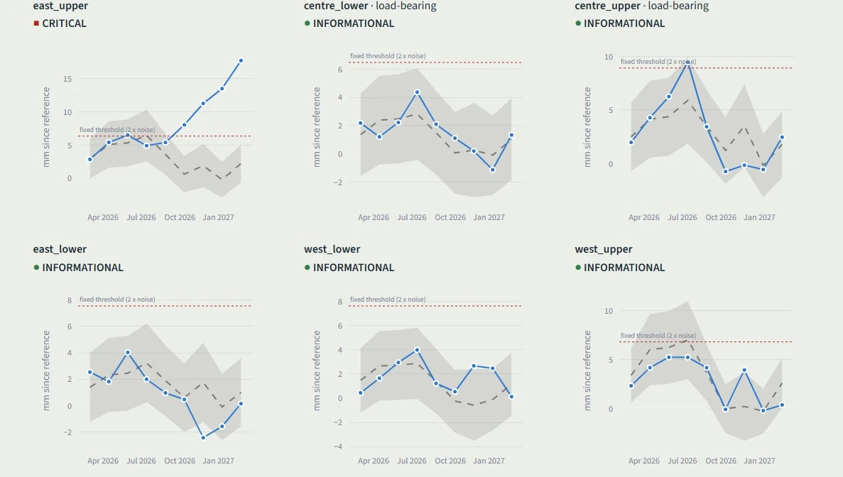
We divided the project into separate modules so different parts could be developed independently while following a common data format. The modules exchange measurements in JSON, using millimetres as the unit, and automated checks help ensure that the components work together correctly. Each module answers one part of the problem: can we trust the photos, what moved, is it the season or real damage, and who needs to act. - Photo capture and preservation: We check image quality and coverage, detect reference markers, maintain an archive with integrity checks, and generate basic architectural drawings. - 3D geometry: We use surveyed reference markers to scale the model, align scans from different visits, and measure structural changes while accounting for uncertainty. - Monitoring and alerts: We analyse changes over time, assign severity levels, route alerts, and maintain inspection records. - Crack detection: We use a U-Net model trained from scratch to identify cracks and estimate their widths from photographs. - Dashboard: We bring the modules together in a Streamlit interface and test the complete workflow using simulated walls and a simulated temple with known measurements. Our simulations demonstrate measurable results. We recovered a planted 12 mm movement as 11.84 mm. In a one-year simulated temple with known truth, KEYSTONE flagged a leaning tower at month 7, while a fixed threshold only triggered at month 10. KEYSTONE also caught beam and plinth movement that the fixed threshold never flagged. These results come from simulated data, where the actual movement is known and every measurement can be checked.
Challenges we ran into
We didn't have a real-monument dataset, so we built simulators with known truth. This lets us compare every measurement against the actual movement and check our results. To separate seasonal changes from structural damage, we built a seasonal model fitted on peer regions, temperature, and rainfall. We also found a false alert caused by a settling column affecting neighbouring regions, which we are now tuning. Narrow cracks are difficult to resolve in 3D, so we measure their widths directly from 2D photographs using a dedicated crack model. For plain walls, we added automatic reconstruction retries and keep the best result.
What's next
Next, we take KEYSTONE to a real monument. - Field test: Use printed scale markers and a deliberately introduced, independently measured change to evaluate our measurements against the 1 to 3 cm target. - Better crack detection: Fine-tune our current model, which was trained on concrete, using historic masonry images. - Detailed 3D visualisation: Build a dense 3D viewer to make structural changes easier to inspect. - Seasonal monitoring: Collect repeat captures across different seasons to improve our understanding of normal movement and distinguish it from structural damage. Our focus is to move from controlled simulations to field validation, building on the measurement and monitoring pipeline we have already developed.
Screenshots
0 comments
Sign in to upvote this project or leave the team a comment.